A tropical depression, currently being monitored outside the Philippine Area of Responsibility (PAR), may enter the country’s monitoring zone next week. However, the Philippine Atmospheric, Geophysical and Astronomical Services Administration (PAGASA) emphasized that the chance of landfall remains low.
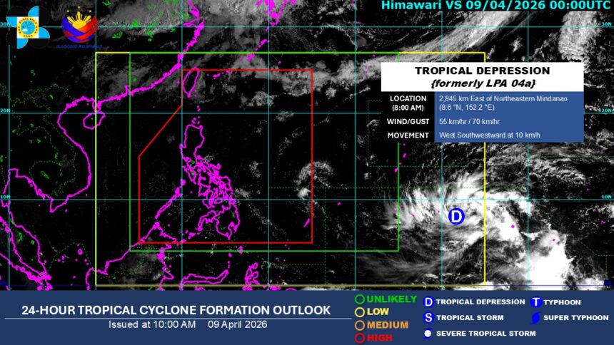
As of 8 a.m., Thursday, April 9, the tropical depression, to be named “Caloy,” was located about 2,845 kilometers east of northeastern Mindanao and is moving west-southwestward at 10 kilometers per hour (kph).
PAGASA weather specialist Chenel Dominguez said the tropical depression may still shift northward in the coming days, resulting in a low landfall scenario for the Philippines.
However, she said this outlook may still change as the cyclone remains far from the country.
The tropical depression has maximum sustained winds of 55 kph near the center and gustiness of up to 70 kph.
Dominguez said it may further intensify into a typhoon, adding that super typhoon strength cannot yet be ruled out.
As of Thursday, a ridge of high-pressure area (HPA) extending across Northern and Central Luzon, together with the easterlies, continues to dominate weather conditions.
These systems are expected to bring hot and humid conditions, with partly cloudy to cloudy skies and isolated rain showers or thunderstorms across the country.
The ridge of HPA is an anti-cyclonic system associated with fair weather, while easterlies refer to warm winds from the Pacific that bring humid conditions and localized rain.
On April 9, PAGASA said Metro Manila may experience heat index levels of 37 to 38 degrees Celsius. (Ellalyn de Vera Ruiz)