By Ellalyn De Vera-Ruiz
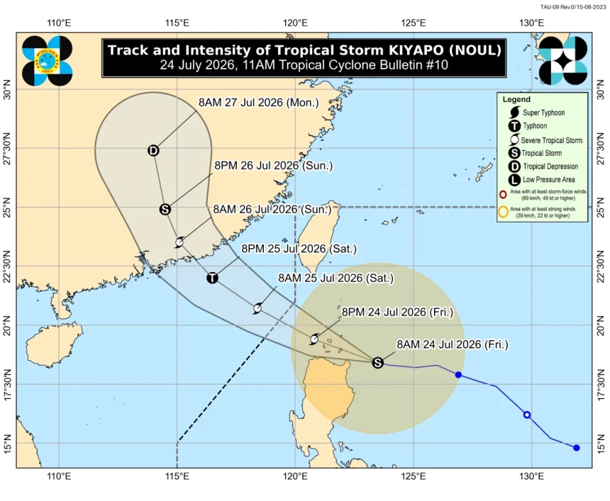
The Philippine Atmospheric, Geophysical and Astronomical Services Administration (PAGASA) warned Friday, July 24, that Tropical Storm Kiyapo (international name “Noul”) may bring heavy rains, strong winds, and dangerous conditions as it nears northeastern Cagayan and the Babuyan Islands.
As of 11 a.m., Kiyapo was tracked 135 kilometers east of Aparri, Cagayan, packing maximum sustained winds of 75 kilometers per hour (kph) and gusts of up to 90 kph, moving westward at 30 kph.
PAGASA said the storm could pass close to northeastern Cagayan by midday before making landfall over the Babuyan Islands later in the afternoon or evening.
The agency raised Tropical Cyclone Wind Signal No. 2 over Batanes, northern Cagayan including the Babuyan Islands, parts of Apayao, and northern Ilocos Norte, warning of minor to moderate impacts from gale‑force winds.
Signal No. 1 was hoisted over surrounding provinces, where minimal to minor impacts are expected. PAGASA cautioned that Signal No. 3 may be raised if Kiyapo intensifies further.
Heavy to intense rainfall of 100 to 200 millimeters is forecast over Batanes, Cagayan, Apayao, and Ilocos Norte until Saturday noon, with moderate to heavy rains expected in Isabela, Kalinga, Abra, Benguet, Ilocos Sur, and La Union.
The southwest monsoon or habagat will also bring significant rains to Occidental Mindoro, Palawan, Antique, Iloilo, Guimaras, and Negros Occidental.
PAGASA warned of possible flash floods and landslides, urging residents in vulnerable areas to remain alert and heed official advisories as the storm moves closer to northern Luzon.