The tropical cyclone internationally known as “Fung-wong” has intensified into a severe tropical storm and is expected to enter the Philippine area of responsibility (PAR) by Friday evening or Saturday morning, Nov. 8, when it will be locally named “Uwan.”
The Philippine Atmospheric, Geophysical and Astronomical Services Administration (PAGASA) warned that Uwan’s wide circulation could bring strong winds and heavy rains to a much larger area, potentially affecting nearly all of Luzon and a significant portion of the Visayas.
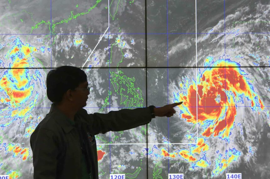
As of 4 a.m., PAGASA weather specialist Loriedin de la Cruz-Galicia said Fung-wong was located 1,525 kilometers east of northeastern Mindanao, packing maximum sustained winds of 95 kilometers per hour (kph) near the center and gustiness of up to 115 kph. It was moving northwestward at 10 kph.
“May kabagalan ang pagkilos kung kaya may mataas pa ‘yung tyansa na mas lumakas po ito. Makakaipon pa ito ng lakas habang nasa karagatan sa mga susunod na araw,” de la Cruz-Galicia said.
“Hindi lamang po tayo dapat sa landfall naka-focus dahil napakalawak ng diametro nitong bagyo. Its radius is extending 400 kilometers from the center. Kung ipo-project natin ito habang papalapit sa bansa, halos buong Luzon at malaking bahagi ng Visayas ang apektado nitong bagyo,” she added.
PAGASA said Tropical Cyclone Wind Signal No. 1 may be raised as early as Friday evening or Saturday morning over the eastern portions of Luzon and Eastern Visayas.
The highest possible wind signal that could be raised during its passage is Signal No. 5 if Fung-wong reaches the super typhoon category.
The onset of heavy rains is expected by early Sunday, Nov. 9, while potentially life-threatening weather may occur over Northern and portions of Central Luzon on Monday and Tuesday, Nov. 10 and 11.
“Matinding paghahanda ang iminumungkahi natin sa ating mga kababayan, lalong-lalo na sa mga maaapektuhan na lugar,” de la Cruz-Galicia said. (Ellalyn De Vera-Ruiz)